
Archive Record
Images
Metadata
Object ID |
2009.1056.03 |
Title |
Origins II |
Object Name |
Book |
Date |
1976 |
Creator |
Neighborhood Planning Councils #2 and #3/Wilson High School |
Description |
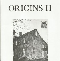
INTRODUCTION Origins II is an example of a nationwide return to local history occasioned by the celebration of our Bicentennial. It includes articles written by a group of high school students who discovered for themselves the particular legends, personalities and events which formed their neighborhoods in northwest Washington, D.C. In a country where the concerns of each individual are supposed to have an impact, it becomes particularly important to study history at its most personal level. It is our hope that all who read this magazine will be able to understand something of individual life in America's history. In Washington, where most of the national Bicentennial celebration will take place, the residents must make special efforts to retain their local historical perspective. The Washington Rediscovery projects, coordinated by the Office of Bicentennial Programs, have played a major role in documenting and publicizing the history of Washington's neighborhoods. Origins II, as one of these projects, was done by fifteen high school students during the summer of 1975. Armed with tape recorders and notebooks these students spent their summer interviewing older people and doing research in libraries, archives and museums. This process was one of the most beneficial aspects of the project not only to the students, but to the community as a whole. The students employed many of the research techniques used by professional historians. The community benefitted not only by gaining a sense of its continuity with the past, but by experiencing the coming together of old and young people as neighbors with a common heritage. Included in Origins II will be material never published before. Some of the subjects covered the architecture of upper northwest, the history of the Colonel Joseph Belt family and their land holdings, the early mills which operated in this area, and the Civil War defense of Northwest, D.C. Also, the business development of the area and the evolution of certain community institutions are explored. The list of people and organizations we must thank is illustrative of the kind of community input and support that Origins II received. First, the project owes its life to Neighborhood Planning Council #2 and #3, who provided funds to pay the students and provided supplies for layout and production. We would also like to thank: Julie Koczela, Administrative Director for N.P.C. #2 and #3, for her support and patience. Jane Midgley, who helped with the editing, layout, and production. Phil Stewart and Ron Geigel, who coordinated the project with the Office of Youth Opportunity Services. Margaret Murray, for her help with the photography and her valuable advice. Tony Sarmiento, who coordinates the citywide bicentennial youth projects for the Office of Bicentennial Programs, and who provided the original inspiration for the Origins project, for his continuing support. Judy Helm, local historian who was kind enough to edit the articles. Robert Truax, a local historian, who gave valuable assistance. Mrs. Ann Pope and Mrs. Dorothy Servatius, who helped with lettering and design on projects during the summer. Rev. Mike Jennings and the Blessed Sacrament Church for the office space they contributed. The staffs of the Washingtonia division at the Martin Luther King Library, the Archives, the Chevy Chase Branch Public Library, the Columbia Historical Society, and Mrs. Sue Hannan, librarian at Blessed Sacrament. And finally, our thanks go to the following people who generously shared their memories with us: Mrs. Edith Jarvis, Mr. Irving Zirpel, Mrs. Harrison, Mr. and Mrs. Robert Williams, Mr. Walton Shipley, Mr. Alan Korz, Mrs. Roberta Barnes, Miss Frances Pepper, Mr. Ron Webb, Mr. E. Kent Clark, Miss Gertrude Good, Mrs. Ida Bondareff, Mrs. Helen Feldberg, Mr. William Belt, Mr. Ronald Kline, Mr. Costello, Mrs. J. Dwyer, Mrs. E. Edwards, Mrs. Alice Doolan, and Mrs. Esther Cantrel. Dorothy Bowles for the typesettir ORIGINS The publication you are about to read is not only the product of this past summer's work, but that of the work of the two preceding summers which shaped this area's bicentennial history project. The program which resulted in the first issue of ORIGINS in 1974 was founded in the summer of 1973 by nineteen high school students under the direction of Mrs. Martha Beshers, with the help of Tony Sarmiento, who is now coordinator for the D.C. Bicentennial's youth local history projects. This group researched and wrote walking tours: two of Chevy Chase,, one of Cleveland Park, and one of Tenleytown. With the exception of the Tenleytown tour, which was published in the Sentry Post newspaper in the fall of 1973, these tours were not published until early 1975, due to staffing and financial problems. By that time, a staff of ten students had finished the research, writing and lay out of the first issue of ORIGINS. With much help from Jane Midgley, publication director, ORIGINS came out in February. Our work proved very successful; we sold close to 1500 copies and created a name and a reputation for the second staff of ORIGINS. Every publication, however, needs a great deal of financial as well as moral support, for staff salaries, supplies and printing costs, and ORIGINS has been no exception. This support, along with the money from the sales of the first issue, has been entirely provided by the Neighborhood Planning Councils 2 and 3. The Neighborhood Planning Council has provided funds for the director's salary, printing and supplies, and has arranged for youth staff members to be paid under the Washington Youth Corps summer jobs program, sponsored by the Mayor's Office of Youth Opportunity Services. Including the fifteen staff members of ORIGINS, N.P.C. 2 and 3 placed 60 youth in WYC positions in the summer of 1975. The Neighborhood Planning Council is a community service organization established in 1968 by the D.C. Board of Commissioners and the Mayor, to develop and fund programs in Washington to involve young people in the planning and implementation of worthwhile activities. The city is divided in 20 N.P.C.s and this year each area received $30,000 in D.C. funds through the Youth Opportunity Services plus additional funds based on the amount of poverty youth in each area. These appropriated funds are then allocated to community groups and projects according to the needs of the area's youth. Representatives of any group that serves the young people of N.P.C. 2 or 3 may present proposals to the Neighborhood Planning Council members each spring. The proposals are reviewed, and the board and membership vote to either approve or reject these proposals. Then it is up to the N.P.C. Administrative Unit, in conjunction with the Youth Opportunity Services to administer the funds and evaluate the funded programs. Besides ORIGINS, N.P.C. 2 and 3 support the Blessed Sacrament Teen Center, the popular Ft. Reno concerts in the summer, a youth Video program, and the Lafayette And Murch After School programs, among others. Information about these programs can be obtained from Julie B. Koczela, N.P.C. 2 and 3 Administrative Unit Director, at the new N.P.C. office at 4025 Chesapeake St., N.W. The phone number is 244-7774. Although N.P.C. 2 and 3 have a joint Administrative Unit, they have separate boards and usually conduct separate meetings. Anyone aged 13 or over living in N.P.C. 2 or 3 (see map) is automatically a member, and if he or she attends their area's meetings, will be placed on the N.P.C. mailing list to receive the monthly newsletter and calendar. Or, if you call in and give your name and Photo by Margaret Murray address, the N.P.C. staff will make sure you're kept informed of the activities of your N.P.C. Annual elections are held in the spring to elect officers and board members in each area. The board serves their Neighborhood Planning Council by working with the Youth Opportunity Services and the Administrative Unit director to keep them aware of the needs of its community's youth. The Neighborhood Planning Council system is unique in that it stresses the participation of young people in community and government affairs and allows them to vote in the N.P.C. elections. By bringing together youth and adults to plan programs, the Neighborhood Planning Council has provided an outlet for the youth's ideas, and has provided the adults with a special insight into the problems and needs of the community's young people. Margaret Murray, Youth Chairperson, N.P.C. 2 THE BELTS OF CHEVY CHASE Vincent Brown Up until the early eighteenth century, the area between Rock Creek and the Potomac River was a land of primitive paradise, a natural wonderland in which man took second place to nature. It was land such as this that the Indian would lay down his life for, and that the white man in all his civilized wisdom would ultimately destroy. It was a land of plenty, thickly forested and abundantly populated with all kinds of game. The creeks and rivers were filled with fish, and wild nuts, berries, and fruits abounded. There were large quarries of soapstone, quartzite, and other stone out of which tools and weapons were fashioned. The Piscataways, a branch of the Algonquin Nation, were the last native Americans to inhabit the Potomac Valley. Their homes stretched northward from the Anacostia River as far as what is now Chevy Chase Circle. Then in the early 17th century the Europeans came to America. The Piscataways retreated to the West as did most of the East Coast Indians. By the early seventeen hundreds there were no Indians north of the Anacostia River. In 1722 surveyors for Avalon, Lord Baron of Baltimore, increased his power and possessions by surveying much of the land south of Baltimore A reconstruction of the Belt coat of arms done by a later member of the Belt family. The area around Chevy Chase circle in 1903 was an open field broken onlyby Connecticut Avenue. The only building on Connecticut Avenue was the yet unnamed E.V. Brown School. Thesmall building to the school's N.E. is the old Belt home. including a large tract of land west of Rock Creek.Lord Baltimore. A patent for the 500 acres, plus So for the first time Chevy Chase, still unnamed,sixth additional acres, was issued July 10, 1725, in was officially owned by a white man. The warrantagreement with Avalon, Lord Baron of Baltimore, for the 500 acres was dated January 12, 1721.and Charles, Absolute Lord Proprietary of the In 1635, a twenty year old adventurer by theprovinceofMaryland,officiatedbyRichard name of Humphrey Belt ended his journey fromTilgham. keeper of the Great Seal. The name was Gravesend, England, landing in Jamestown. Heagreed to be Cheivy Chace and was so written on married and had a family. Twenty eight years laterthe patent. Thus Lieutenant Colonel Joseph Belt Humphrey Belt and his family moved to Annereceived his estate and Chevy Chase was born. Arundel County, Maryland. This is where the BeltWheredidthename"CheivyChace" household settled. In 1680 a grandson was born tooriginate? In 1388 Lord Percy of England fought Belt, who was christened Joseph. Joseph Belt spentEarl Douglass of Scotland over the ownership of a his youth in Anne Arundel County with his family.hunting ground or "chase" in the Cheviot Hills of In 1707, the twenty seven year old Belt marriedNorthumberland, England. The Cheviot Hills were Esther Beall, the daughter of Colonel Ninian Beallso named because they marked the boundary of Anne Arundel County.between England and Scotland. The word cheviot In1725Joseph Beltbeamea lieutenantis derived from a French word meaning obstruc- colonel of the King's army in the colonies. Duringtion. So "Chevy Chase" comes from a name the same year, he acquired large land holdings frommeaning "borderline hunting ground." In later The area around Chevy Chase Circle, 1968. centuries, the battle became famous and several ballads were written relating its story. In the English version of the ballad, Douglass questions Percy, "Who gave youe leave to hunte in this Chyviat Chase?" But why did Belt choose this name for his estate? There are several plausible reasons. For one, the Potomac Valley area was inhabited primarily by Scottish settlers, while the area north of Chevy Chase, including Baltimore, was English. The woods of Chevy Chase provided excellent hunting grounds, as did the Cheivy Chace of England. So Chevy Chase seems to have formed a borderline hunting ground, Scottish on one side and English on the other, as was the chase in the Cheviot Hills of Britain. Belt may have wanted to commemorate the ancient site in honor of. the unification of the British Isles eighteen years before establishing Great Britain. It is also interesting to know that Joseph Belt's wife was of pure Scottish blood while Belt, of course, was of English descent. When Belt first arrived in Cheivy Chace there was nothing but the woodland paradise that the Indians had so hastily left behind. Belt had great plans for Cheivy Chace which he wasted no time in carrying out. His land was to be a large farm and manor with plenty of room for hunting in the extensive area which remained wooded. So he cleared a place for his manor house, one of simple colonial design, and imported bricks and nails from England. Within the same year Belt had completed his new house, a house which would stand for almost two centuries. Belt settled his wife and six children in their new home, bought slaves, planted, and an estate was begun. Colonel Belt quickly rose to a high position in colonial social life, becoming a full colonel in command of a regiment of colonial militia in 1728, a representative of Prince Georges County in the House of Burgesses, a member of the Gentlemen Justices of Prince Georges County, one of the establishers of the Maryland public schools, an accomplished surveyor, and the owner and head of his large estate. He often assisted Colonel Beall in keeping the Susquehanna Indians, to the north, in order. Colonel Belt led his regiment in the French and Indian War. He also founded the Episcopal Rock Creek Parish, one of Washington's oldest. Belt died in 1761 at the age of eighty one. It is said that he died of grief for his favorite son, Joseph Jr., who died a short time before. The Belt property was divided between two of Joseph Jr.'s sons. The Colonel's grandson Thomas received the half of the property with the house on it, and the grandson William received the western portion. It is not known where Belt was buried; but he may lie in the family graveyard at Chevy Chase. The manor house was located about 500 yards southeast of what is now Chevy Chase Circle. The present house, at 3734 Oliver Street N.W., stands in the exact spot that the colonial manor house occupied. In fact the present house was actually built on some of the old house's brick foundations. The Belt house remained standing until 1907 when a Mr. Brainard W. Parker bought the plot from the Chevy Chase Land Company, and proceeded to rip down the aged landmark and built a nice summer home for himself. Thus Chevy Chase lost its oldest and most precious landmark. The Belt home stood through the most important times of American history. Slaves had worked in the fields and house while colonial society held meetings there. Three of Joseph Belt's sons and eight of his grandsons, who had lived in the house, fought for independence in the Revolution. In 1814, when the British captured Washington, members of the Cabinet hid in Chevy Chase with valuable Post Office records and records from other government departments until the city was freed. The inhabitants of the old house heard Union troops marching to nearby Fort Reno during the War Between the States. So the Belt house stood from Colonial times until the age of invention was well under way. What finally happened to the Belt land? In the 1880s the Belt heirs sold what they still owned of the estate to numerous businessmen and speculators. The formers of The Chevy Chase Land Company methodically bought what they didn't already own of the land from them and eventually obtained all of it. After they owned all of the land, they planned roads dividing it into blocks and later lots on each side of the newly extended Connecticut Avenue. The only previously existing roads were Belt Road and Broad Branch Road. Belt Road, previously called the Brookeville Road, still exists in fragments among the blocks of residential Chevy Chase, D.C. The still existing Broad Branch Road was named for the Broad Branch of Rock Creek. Broad Branch Road ran along the side of a hill with the branch at the bottom. The hill is now striped by streets with rows of houses leading from top to bottom. From the head waters down to its middle, the Broad Branch is now covered by Nevada Avenue.i The Belt graveyard covered a surprisingly A' Colonel Joseph Belt's Manor house, built about 1722. arge section of land just east of the manor house, =erween it and the Broad Branch. Gravestones :overed an area about as big as five or six medium sized residential lots until the mid twenties when re` were removed. E. Kent Clark, a resident of Oliver Street in the twenties, wrote: Just past where we lived on Oliver Street the land dropped steeply. It was a good sledding hill, and one had to make a sharp right turn at the bottom of the hill. If you didn't make a turn you had to dodge the tombstones in an old cemetery. Around fourteen human skeletons were uncovered during the construction of the house at 5724 Chevy Chase Parkway, also in the twenties. The construction crew refused to work with the pelvises, skulls and other remains lying around the newly dug basement. So the builders picked them up and carted them away. By 1930, Chevy Chase looked very much like it does now, with the residential section nearly completed. No more evidence of the farm or house was visible. So ended 200 years of history. But, history will never be completely erased, for under the lawns, houses and streets of Chevy Chase, men of a bygone era rest peacefully, unknown by the people who occupy the land they once walked. SOURCES 1. Baist's Real Estate Atlas of Surveys of Washington, D.C. Volume 3, G.W. Baist, 1903. 2. Baist's Real Estate Atlas of Surveys of Washington, D.C. Volume 3, O.W. Baist, 1968. 3. Belt, William. A private collection of articles, letters, and papers, written and compiled by members of the Belt family. 4. The Chevy Chase News, March 1921. A History of Chevy Chase by Miss Ella Given 5. D.C. Recorder of Deeds, Rec. Lib. Co. 21 Fol. 41. 6. The Evening Star, February 3, 1964. On The Side: Chevy Chase Ballad Tells Story of Fight, by Phillip H. Love. 7. Footsteps: Walking Tours of Chevy Chase and Cleveland Park, Neighborhood Planning Councils #2 and #3, 1975. 8. Kline, Donald C. Teacher, artist, and architect of many Chevy Chase homes, interviewed July '75. 9. Magruder, Caleb Clarke. Colonel Joseph Belt, a paper read before the Society of Colonial Wars. 10. The Montgomery County Story, Volume 2. Colonel Ninian Beall/Colonel Joseph Belt, by Martha Sprigg Poole, Mont. County Historical Society. 11. National Archives. Microfilm census records, National Census of 1790. 12. National Archives. Building permits, record group 351, building permit 1836. 13. The Sunday Star, June 5, 1938. Famed Families in Nearby Suburbs, by John Clagett Proctor. |