Library Record
Images

Metadata
Object ID |
2010.1043.01 |
Title |
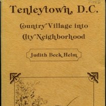
Tenleytown, DC: Country Village into City Neighborhood |
Object Name |
Book |
Author |
Helm, Judith Beck |
Publisher |
Tennally Press |
Published Date |
1981 |
Published Place |
Washington, D.C. |
Description |
Tenleytown, DC: Country Village into City Neighborhood By Judith Beck Helm Softcover, 1981, 602 pages Tennally Press, Washington, DC Includes index. Bibliography: p. 585-597. Inside cover, hand-written: Eleanor Johnston Ford January, 1982 Chevy Chase Contents: Introduction Acknowledgements 1. The Beginnings: Before 1790 2. The Tennallys and Tennallytown: 1790-1860 3. The War Between the States Comes to Tennallytown: 1861-1865 4. The Growing Village: 1865-1899 5. Peaceful Days: 1900-1914 6. Changes: 1914-1939 7. Modern Times: 1940-1981 Bibliography Index p. 237-238: Connecticut Avenue Extended to Chevy Chase About 1886 Congressman Francis G. Newlands of Nevada conceived the idea of extending Connecticut Avenue northward through Washington County and building an ideal suburb at its terminus. Until then, the intervening land east of the Tennallytown Road and west of the 14th Street Road had remained rural, with only a very few country lanes. The Rock Creek area was not set aside as a park until 1890; it was then farms and woodlands. The story goes that in 1889 Newlands visited the home of Major George A. Armes, whose estate "Fairfield" was located on Grant Road, three-fourths of a mile east of the Tennallytown Road. From the top floor of Armes' home, Newlands surveyed the land to the south, west, and north, and, with the encouragement of Major Armes, determined the route that Connecticut Avenue extended should take. In fact, Newlands originally planned Connecticut Avenue to meet the Road to Rockville north of the District line, and wanted his new suburb there. But when he and his brokers began trying to buy up the land on which the road would travel, they ran into obstacles. So it was decided that the Connecticut Avenue extension would parallel the Road to Rockville, and not intersect it. The Chevy Chase Land Company was incorporated as purchaser of the farm land. The land that was bought extended from what is now Connecticut Avenue and Calvert Street about three and a quarter miles northwest to the District line and about two miles due north into Maryland; 304 acres of the original "Cheivy Chace" tract were acquired from the Bradley family. According to George Armes1 journal, he bought 47 acres from the Payne family of Grant Road in 1890, for $500 rxer acre, for the Chevy Chase Land Company. ' Other local lands were acquired — including parts of the Shoemaker, Noonan, Ryan, Gates, and French tracts — under the supervision of Edward J. Stellwagen. This acquisition of property for the extension of Connecticut Avenue was unblushingly hailed as "the most notable transaction that has ever been known in the history of suburban property." In order to construct the Connecticut Avenue extension and provide streetcar service to Chevy Chase, it was necessary first to grade the land and build bridges; then to build a power plant, at Chevy Chase Lake; and finally, to lay the tracks for the streetcars. Chevy Chase Lake was a family entertainment spot built by the Chevy Chase Land Company. It was located on Coquelin Run, east of Connecticut Avenue and south of today' s B&O Railroad line. The man-made lake was the end of the line for the Chevy Chase streetcars. Eleanor Ford's annotations originally accompanying the book: 1. Ask for fair copy of map in front of Tenleytown book. 2. All grants by Florida Ave. and Beltway, Rock Creek and Wisconsin Ave. Sonnemann: p. 178-180; p. 272 - farm west of Wisconsin and Ellicott Street; p. 415 - H(sp?) Sonnemann of Grant Rd., filled in WWI. Grandson of Walthers of Murdock Mill Rd. (cemetery at St. Columba's) Wisconsin Avenue, p.4 - An 18th century map showing an Indian trail that preceded Wisconsin Avenue/Rockville Pike. Friendship Heights, p. 14 - "The Beginnings: Before 1790." Discusses the largest land grant in the area, called Friendship. Wisconsin Avenue, p. 29 - 19th century map entitled "Early Roads in Montgomery County." Stage Coach, p.59 - Mentioned in "The Tennallys and Tennallytown: 1790-1860." Turnpike, p. 65 - Mentioned in "The Tennallys and Tennallytown: 1790-1860." Turnpike, p. 82 -- Mentioned in "The Tennallys and Tennallytown: 1790-1860." Note on two properties, Grasslands and Dunblane, p. 86 - Grasslands: Discussed on p. 60-64. 250 acres, built circa 1804. Located south side of Nebraska Avenue, west of Tennallytown. In 1885 was summer home of Secretary of Navy, Mrs. William C. Whitney in 1891, occupied S.S. Howland. Dunblane (farm and hall): Discussed on p. 86-88, located north side of Nebraska Avenue at Tennellytown, built 1800. It is still standing, NE corner of 42nd and Warren Streets - Immaculate Junior College. IN 1885 it was occupied by Charles Briacoe (sp?). Streetcar, p. 235 - Mentioned in "The Growing Village: 1865-1899." Willows, p. 243 - Photograph of The Willows Hotel and Restaurant, on east side of Wisconsin Avenue. Friendship Heights/Offutt, p. 369 - Discussion of this neighborhood in "Peaceful Days: 1900-1914." Friendship Heights on Streetcars, p. 373 - Mentioned in "Peaceful Days: 1900-1914" Howard Johnson's to 1977, p. 525 - Photograph from 1942 located across the Howard Johnson's, corner of Wisconsin and Western Avenues. Chevy Chase Center, p. 542 - Discussed in "Modern Times: 1940-1980." Friendship Heights development, p. 563 - Discussed in "Modern Times: 1940-1981." Wisconsin Avenue traffic, p. 566 -- Discussed in "Modern Times: 1940-1981." Duplicate is 1987.20.01 |
